We had a big hike planned for Wednesday – the 621m ascent of Mount Hobson, the highest point on the island. After preparing lunch (copious egg sandwiches) and having our breakfast we took the dinghy ashore to Bush beach on the south side of the bay we’re anchored in.
 Expecting a nice coastal walk to begin our hike we were, instead, presented with a steep climb up above the beach. At the top we were presented with our first sign post to the summit declaring it to be 3½ hours away.
We walked on through typical splendid New Zealand forestry along the Kaiaraara Track that would eventually lead us up to the summit. We had to cross streams a number of times via suspension bridges and wooden bridges.
 We eventually reached a pretty well preserved kauri dam. We learned these were used to build up a head of water behind them where loggers would stack kauri logs. When they had enough they would trip the dam creating a deluge of water and logs down the stream smashing down everything in its way. Apparently it could be heard for miles.
We rested here for a while refreshing ourselves with an orange each. Here we jinxed our future by discussed our recollection of what we’d been told by the guide at the DOC field center a few days before. I felt we were on the shorter, steeper path up to the summit which the guide had said had a lot of steps. Helen came out with the fatal words along the lines that she felt we really hadn’t seen too many steps.
 The path onward from the dam was less maintained than the path to that point. Up until then, we either had gravel path with drainage on one side or wooden steps/walk ways. Now we were on a rough path having to climb over rocks and roots with occasional wooden steps. Initially that is. But this was a lot more tiring than the well made path.
Then the steps began. And never stopped it seemed. In hindsight I think it was nearly half an hour of continuous climbing and for a large part up 45 degree slope. We both found a pace which we could simply continue without stop. One step after the other. We learned not to look up as sometimes it was disheartening. We would occasionally be given the impression of reaching the top only to find more steps ahead.
 From time to time we were rewarded with great views looking back to the anchorage we were in. But we knew not to stop too long and savour them as if our muscles cooled and our hearts slowed down it would be a nightmare getting going again.
So we put our heads down and kept putting one foot ahead of the other.
We eventually reached a fork in the path where a sign indicated we had only 2 minutes to reach the summit. This was very encouraging.
 On this last section we met two people coming the opposite direction – the first two people we had met all day. They reassured us that we really were near the top. Perhaps we looked like we needed reassurance.
We made it to the top exactly 2 hours after we’d passed the sign saying it was 3 ½ hours away. While we know the trail guidance here is usually cautious we were quite proud of the time we’d made it in. And this included the stop at the  kauri dam.
At the top we were rewarded with an astounding 360 degree view of the surroundings. We had a light breeze to counter the sun blazing out of a clear blue sky. Can’t think of a much better place to rest, take in the view and scoff our lunch.
But what goes up must come down and soon we shook our tired muscles back to life and headed back down. Given our time up we decided to take a different and longer path down.
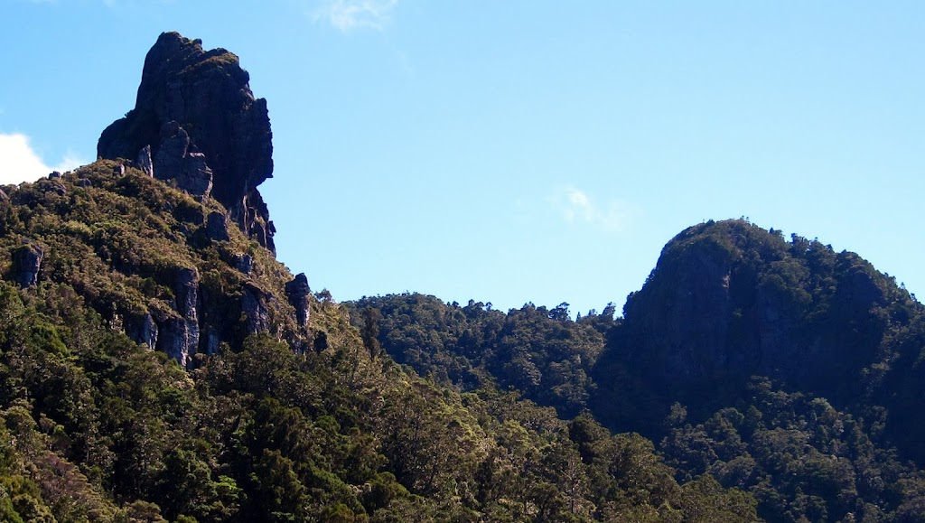 After a long descent down a different set of stairs which made our legs wobbly, this path turned out to be rough all the way down to the forest road. It was also quite slippery in places. We both ended up on our back sides on a few occasions. This meant that almost every step on the way down had to be carefully taken and controlled. It was exhausting. On the upside we were presented with some open views of the summit we had recently ascended and the steepness of the final sections.
 We had more stream crossings to make, often having to ford rather go over a bridge. One bridge we did cross was more like a horizontal steel rope ladder with nets either side. It had a load limit of one person at a time. It was very wobbly and a little scary.
We eventually made it down to the forest road which was a lot easier to walk on. We still had about ½ an hour to reach our dinghy. We reached the boat, with great relief, just under 6 hours after we’d left it in the morning.
We both flopped down and rested. I’d started the water maker before collapsing and was roused from my slumber by the bilge alarm going off for a second time. Turn out one of the high pressure connecters needed a turn with the spanner. With that sorted I was done.
We did get up and about for a delicious curry dinner and a movie in the evening. In our tiredness we were both asleep again quite early.
No surprise, today we both ache. We both have sore knees and our calves and thighs ache. My back and shoulders ache from a couple of heavy falls I took on the way down. We don’t plan on doing too much today.
The following pictures include a few from our first couple of days at Great Barrier Island.
Leave a Reply