Notice: Function _load_textdomain_just_in_time was called incorrectly. Translation loading for the atahualpa domain was triggered too early. This is usually an indicator for some code in the plugin or theme running too early. Translations should be loaded at the init action or later. Please see Debugging in WordPress for more information. (This message was added in version 6.7.0.) in /home3/aboarddi/public_html/blog/wp-includes/functions.php on line 6114
South Pacific « Aboard Dignity (Lagoon 420) Blog

Categories

A sample text widget

Etiam pulvinar consectetur dolor sed malesuada. Ut convallis euismod dolor nec pretium. Nunc ut tristique massa.

Nam sodales mi vitae dolor ullamcorper et vulputate enim accumsan. Morbi orci magna, tincidunt vitae molestie nec, molestie at mi. Nulla nulla lorem, suscipit in posuere in, interdum non magna.

Hot Springs

Even though we didn’t have internet, a morning check of the weather via the email facilities on the side band radio were looking bad for the following week. Some really heavy weather was coming down on Tuesday. Another reason for moving on sooner rather than later. On the radio we heard that the poor folks up in Fiji were bracing themselves for another bout of heavy wet weather. From the sounds of things the nasty low pressure system we’d had our eyes on was currently passing Fiji and on it’s way down here. Joy.

For Saturday, the weather was promising to be good so we headed ashore and tied up at the dock. Our guide said that it was a 40 minute walk to some local hot springs. From the map I had I was somewhat sceptical about this. We popped into the Great Barrier Lodge to see if their shop had fresh milk (they didn’t) and to ask the way to the hot springs. They also said it was 40 minutes walk along the road and gave us directions.

We duly followed their directions and about an hour later reached the trail head to the springs. Here we were told (by the DOC sign) that it was another 2 hours round trip to the hot springs. We know we almost halve the DOC timings so we pressed on and completed the trip another half hour later.

At the hot springs were two couples, all au naturale, enjoying the springs. We joined them and ended up chatting. They were all from Waiheke Island so we received a few interesting tips about visiting. We also received the usual (and very welcome) invitation to visit the couple we were closest to. We’ll see how things work out. We quite like the idea of the cinema there which has casual seating and allows next door take away curries in to be eaten while watching movies.

As we wanted to move the boat we soon bade our farewells and headed back to the start. We popped back into the Great Barrier Lodge to see if they would do lunch but their restaurant was closed for lunch. So we headed back to Dignity for a snack arriving about 4 hours after we left. Some 40 minute trip to the springs????

After lunch we headed off to Typhena Bay. It was another upwind motor, something we can easily contemplate with the diesel engines. We arrive and dropped the hook in Mulberry Bay only to find their was no internet service. We then raised the anchor and moved around the corner so we were in line of sight to the cell phone tower. There we had a signal but not brilliant. We managed a quick Skype call to Ben, Sam and Amy who were with our friends Anne and John. It was nice to see them but the video was almost impossible.

INSERT_MAP

Once we gave up on the Skype call we lowered the dinghy and headed ashore to find the shop. We chose the wrong beach and ended up having to climb up the road that passed over (what I believe to be) Mullberry Hill to reach the next beach. There we picked up some fresh bread (turned out to be sour bread) milk and a few other things. We trudged our way back up over the hill, now feeling a little weary, to the dinghy and headed back to the boat.

This morning the forecasts still point to some very nasty weather coming through on Tuesday so we’ll sit here until that’s past us. We have good holding here and protection from the east and north which is where we’re going to be pummelled from on Tuesday. The winds are currently forecast to be 40 knots gusting up into the high 50s.

It has rained a lot overnight and the wind has picked up a bit. It would be nice to get ashore again before it becomes impossible.
GPS Weirdness

We made our minds to head off to Whangaparapara. This was mainly up wind and hence required us to motor all the way. For the first section we were reasonably sheltered and had flat seas. Once we reached the open sea we had to head directly into the swell which made the ride quite bumpy.

Not long into this leg we lost the GPS signal into our main chart plotter. My first thought was that a cable had come loose so after making sure our heading was safe I took off the panel and checked all the connectors. This didn’t resolve the issue.

I then powered up my portable backup GPS. It came on but it could not pick up a GPS signal. I then checked the GPS reading from the AIS using the computer. It too was registering no GPS signal.

So I had three separate GPS devices all indicating that there was no GPS signal reaching the boat. So we either had a systemic issue or the GPS satellites had been turned off. The latter possibility was quite ominous. Both the reason for switch off and the consequence to boaters was quite scary. To double check I called the coast guard who independently checked this for us. They came back and reassured us the service was up and running.

I now had to figure out why all three of my devices were not picking up a signal. The first thing I tried was turning off the AIS. The GPS signals were now being received by the other two units. That was weird. Getting to our anchorage safely was the priority so I left the troubleshooting till later and took us in.

INSERT_MAP

After lunch and a rest I turned my mind back to the GPS problem. I must admit I was feeling a bit despondent as I was beginning to feel my new AIS setup was causing more problems than benefits.

It took me about 10 seconds to make a key step towards determining cause. The GPS antenna for the AIS had proven itself to work just fine indoors so I hadn’t yet fixed it anywhere. In the bumpy seas it had fallen over and come up against the stainless steel pole at the front of our cabin which supports the mast. As a matter of tidiness I picked it up. I noticed that the portable GPS immediately began to register satellite reception. I put the AIS GPS receiver back against the pole and the portable GPS lost satellite reception. This happened even when the portable GPS was disconnected from the boat power. This was also having the same effects on the GPS reception to the main chartplotter as well as the GPS reception of the AIS unit.

So somehow, proximity between the AIS GPS receiver and the mast pole seemed to be jamming all three units even though there was no physical connection. Very, very strange.

Why this happens baffles me. The actual cause lives in the realm of radio reception, antennae and what not. This is an area of science which, to me, seems close to magic and hence best left well alone.

I know how to replicate the problem and I know how to resolve it. I’d be curious to understand root cause but it won’t keep me awake at night not knowing.

The weather never really turned nice so we stayed aboard for the rest of the day. Hopefully today we can get ashore, visit the shop and walk to the nearby hot springs.

We have no internet here, shock horror. I think we can survive for a while but this may incentivise us to move on sooner rather than later.

Moaning and Groaning

We did a lot of that yesterday. Particularly if we hadn’t moved for a few minutes and then did so. Despite the pain in our muscles and joints we both agreed the cause, the previous day’s hike, was worth it.

Once moving the pain would go away so we did manage to get a couple of chores knocked off the list. Helen waxed the dodger (which protects it from UV) and I WD40d every hinge and catch on the boat. Very tedious but only need be done once a year. It prevents any hinge from seizing and subsequently snapping when used.

Not much else to say about the rest of the day. The weather was far less clear than the previous day. On the day of our hike we set a record on the solar panels – 290Ah made in one day.

Today we may move the boat. One incentive is to get hot water. We’re too stingy to run the generator just for hot water. We’ve no need to charge the batteries because wind/solar is keeping us up and we don’t have enough washing yet to do a wash. The winds, while forecast to be strong, are shifting to easterlies. We should be reasonably sheltered by the island if we move south. There’s a number of possible destinations. We’ll need to discuss our options.

Mount Hobson

We had a big hike planned for Wednesday – the 621m ascent of Mount Hobson, the highest point on the island. After preparing lunch (copious egg sandwiches) and having our breakfast we took the dinghy ashore to Bush beach on the south side of the bay we’re anchored in.

Expecting a nice coastal walk to begin our hike we were, instead, presented with a steep climb up above the beach. At the top we were presented with our first sign post to the summit declaring it to be 3½ hours away.

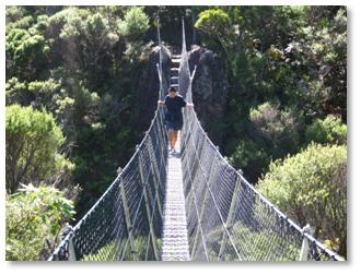
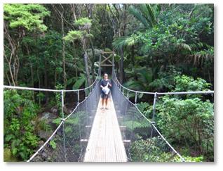
We walked on through typical splendid New Zealand forestry along the Kaiaraara Track that would eventually lead us up to the summit. We had to cross streams a number of times via suspension bridges and wooden bridges.

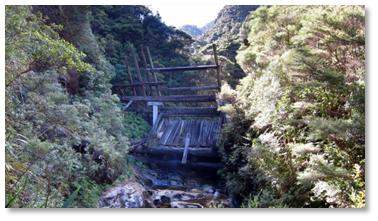
We eventually reached a pretty well preserved kauri dam. We learned these were used to build up a head of water behind them where loggers would stack kauri logs. When they had enough they would trip the dam creating a deluge of water and logs down the stream smashing down everything in its way. Apparently it could be heard for miles.

We rested here for a while refreshing ourselves with an orange each. Here we jinxed our future by discussed our recollection of what we’d been told by the guide at the DOC field center a few days before. I felt we were on the shorter, steeper path up to the summit which the guide had said had a lot of steps. Helen came out with the fatal words along the lines that she felt we really hadn’t seen too many steps.

The path onward from the dam was less maintained than the path to that point. Up until then, we either had gravel path with drainage on one side or wooden steps/walk ways. Now we were on a rough path having to climb over rocks and roots with occasional wooden steps. Initially that is. But this was a lot more tiring than the well made path.

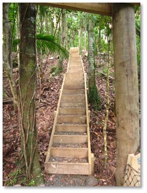
Then the steps began. And never stopped it seemed. In hindsight I think it was nearly half an hour of continuous climbing and for a large part up 45 degree slope. We both found a pace which we could simply continue without stop. One step after the other. We learned not to look up as sometimes it was disheartening. We would occasionally be given the impression of reaching the top only to find more steps ahead.

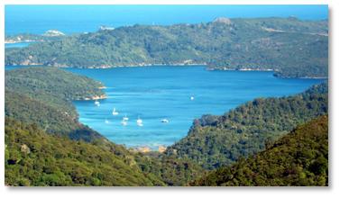
From time to time we were rewarded with great views looking back to the anchorage we were in. But we knew not to stop too long and savour them as if our muscles cooled and our hearts slowed down it would be a nightmare getting going again.

So we put our heads down and kept putting one foot ahead of the other.

We eventually reached a fork in the path where a sign indicated we had only 2 minutes to reach the summit. This was very encouraging.

On this last section we met two people coming the opposite direction – the first two people we had met all day. They reassured us that we really were near the top. Perhaps we looked like we needed reassurance.

We made it to the top exactly 2 hours after we’d passed the sign saying it was 3 ½ hours away. While we know the trail guidance here is usually cautious we were quite proud of the time we’d made it in. And this included the stop at the kauri dam.

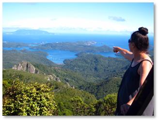
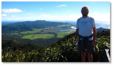
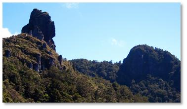
At the top we were rewarded with an astounding 360 degree view of the surroundings. We had a light breeze to counter the sun blazing out of a clear blue sky. Can’t think of a much better place to rest, take in the view and scoff our lunch.

But what goes up must come down and soon we shook our tired muscles back to life and headed back down. Given our time up we decided to take a different and longer path down.

After a long descent down a different set of stairs which made our legs wobbly, this path turned out to be rough all the way down to the forest road. It was also quite slippery in places. We both ended up on our back sides on a few occasions. This meant that almost every step on the way down had to be carefully taken and controlled. It was exhausting. On the upside we were presented with some open views of the summit we had recently ascended and the steepness of the final sections.

We had more stream crossings to make, often having to ford rather go over a bridge. One bridge we did cross was more like a horizontal steel rope ladder with nets either side. It had a load limit of one person at a time. It was very wobbly and a little scary.

We eventually made it down to the forest road which was a lot easier to walk on. We still had about ½ an hour to reach our dinghy. We reached the boat, with great relief, just under 6 hours after we’d left it in the morning.

We both flopped down and rested. I’d started the water maker before collapsing and was roused from my slumber by the bilge alarm going off for a second time. Turn out one of the high pressure connecters needed a turn with the spanner. With that sorted I was done.

We did get up and about for a delicious curry dinner and a movie in the evening. In our tiredness we were both asleep again quite early.

No surprise, today we both ache. We both have sore knees and our calves and thighs ache. My back and shoulders ache from a couple of heavy falls I took on the way down. We don’t plan on doing too much today.

The following pictures include a few from our first couple of days at Great Barrier Island.

Just a nice day

Two appologies to begin with. First, the blog went out late. I wrote it early but it got stuck in my out box which we didn’t notice until late in the day. Second, on reading my blog again I may have misrepresented the size of Port Fitzroy. A reader might easily assume a number of residential/other buildings nestled amongst those that I mentioned. No. Sorry. That was mostly it.

So yesterday was simply one of those days that was just nice. After a bit of a lie in I got out in the dinghy and fished in a spot recommended by the lady in the shop and caught a couple of red snapper. Not very big but big enough. They came back to the boat, were popped in a bag and put in the fridge for later disassembly.

We then went ashore for our walk. It was nearly high tide so we had no problems with the mud. We walked to the nearby campsite and dropped of our trash and then hiked the Warren trail that took us up through the woods, past a cascading waterfall and then met the bridle path we’d been on the previous day. We carried on into Port Fitzroy to pick up some fresh veg to go with the fresh fish.

Next stop was the burger bar down by the ferry dock. It turned out to be open and we ordered a burger and fries each. They turned out delicious but way too much for us. We could have got by sharing a portion of fries between us.

Back at the boat I had a little siesta before we moved the boat round to Kaiarara Bay ready for our hike today.

The rest of the afternoon was relaxing and reading. The sky was blue and the sea flat. We gently floated around our anchor with the surrounding green hills moving around us. Very serene.

Finished off the day watching Invictus. A pretty good movie about the Springboks and their world cup attempt immediately following the end of Apartheid.