To give the summary up front – this was one hell of a hike. As Helen put it towards the end, it’s  up there in our top 5 amongst hikes like the Grand Canyon, Half Dome in Yosemite and the Boiling Lake hike in Dominica (we couldn’t figure out a hike to definitely put in a top 5 so it’s a top 4). The downside that comes from this is that it’s a very popular hike so it’s good for those who like company on the trail but not so good for those looking for solitude. You’ll notice that most of our (many) pictures of this hike include other people in view. This is after trying to capture pics without them and deleting those that were too crowded.
The trail is a 19.4km one way hike with and elevation of 1,100m at one end and 750m at the other end with a maximum trail elevation (not including side trips) of 1,900m. Transport of some sort needs to be arranged and we used the commercial service available from the campsite. 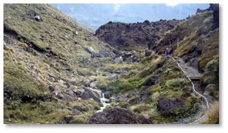 Naturally the preferred route is to start at the higher end as not only does it involve less ascent but as almost everyone goes this direction, going the other way would require a lot of wading past hundreds of hikers traveling the opposite direction (although it would give plenty of time alone on the trail).
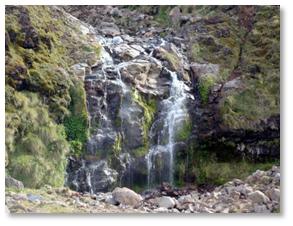 The first section of the trail was a gentle climb of around 250m covering about a quarter of the overall hike distance taking us to a stop called Soda Springs. The trail at times scrambled over rough rocks but, as seems to be the case here in New Zealand, was mostly well made, filled in with gravel and at times over wooden walkways. We walked alongside streams and waterfalls and often had amazing rock formations towering over us. To our right was the iconic volcanic cone of Mount Ngauruhoe (which I believe was used for Mount Doom in the Lord of the Rings filming). The landscape was all volcanic followed by natural erosion in origin with lava fields and meandering stream beds cutting through layered rocks. It
 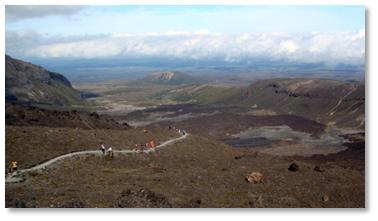 very much felt like geology on the go even though the last eruption was many thousands of years ago.
We took the side trail at Soda Springs to escape the crowds and to have a drink and a small snack. The next section of the trail was the steep 300m climb up to a plateau containing the South Crater.
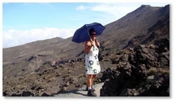 On each stretch of the hike Ben and Sam were happy to leave us oldies behind and wait for us at the next stop. With the morning clouds burning off and the sun blazing through, Helen, continued to set hiking fashion and was the only one of many people on the mountain in a dress and carrying an umbrella. As far as she’s concerned she’s the most comfortable person on the trail. I think the hiking boots fully compliment the picture.
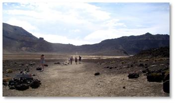 At the top of this climb we reached a plateau which led to the south crater. It looked to me as though the crater had been filled with sand over the years making the area into what felt like a desert. It felt as if we’d been transported into another world altogether. The air was chill but it looked like a hot desert. Mount Doom towered over us with all the hues and colours standing out in the clear sunshine.
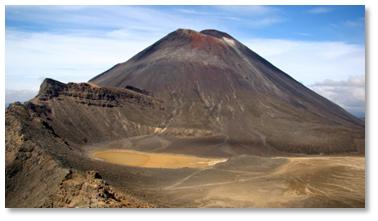 We were soon climbing again up to the rim of Red Crater. All around us were postcard views. At this point I’m struggling to decide which ones to include in the blog as I only have so much space on the page and bandwidth to upload them. You’ll have to wait until I can upload the entire album to see the rest.
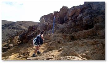 The climb up to Red Crater was a little rugged with a lot more rocks to scramble over than we’d had to before and with a lot of gravely slopes which required good footing to prevent sliding back down. The effort was again worth it as the views behind us just got
 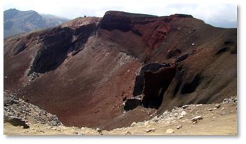 better and better and the view of the Red Crater ahead of us, when it appeared, was a fresh new surprise. It was quite crowded here as it was a natural stop for lunch.
Ben and Sam were again waiting for us here. They’d found a reasonable big rock to sit down behind and shelter from the cool wind. Here we ate our lunch and took a short break to rest our legs before the final climb to the highest point of the trail on the lip of the Red Crater. The Red Crater was aptly named and again an amazing sight. I hope the use of 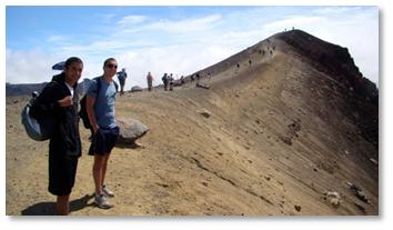 superlatives is not diminishing as this was not the first or last amazing sight on this trip. The rocks were truly reddish in hue. There was a curious feature on the far side of the rim which looked like some sort of lava tube that had long since disgorged its contents and solidified around the outside.
After eating our lunch we made the final push to the highest point of our hike. As we approached the summit we were presented with more (dare I say it) amazing views. 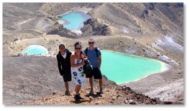 First, in the distance, the Blue Lake appeared. At the top we could look down and see the stunning Emerald Lakes.
These three lakes were so full of minerals they’d taken on a striking blue/green colour – vivid in the overhead sunlight. The trail down from the top was steep and very gravelly. It appeared to me that the gravel was placed there to make it easier to descend without falling over. 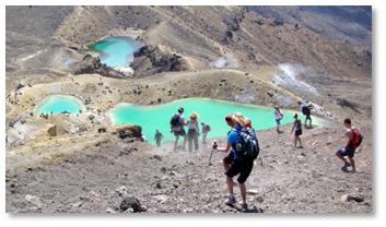 As it was we had to almost ski down rather than walk normally. With all the other hikers slip sliding their way down the feeling of being on a beginners ski slope was reinforced.
Ben, Sam and I took the long and slippery way around the third Emerald Lake. This one’s edges had vegetation growing in the water. It had a rich, orangey red stream trickling into it. The contrasting colours were extremely rich. Around the far rim of the lake sulphur smelling steam was emerging from the ground reminding us of the nascent energies beneath our feet.
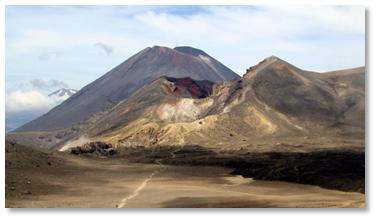 We had another plateau to cross before a final 100m climb to the rim overlooking Blue Lake. Behind us was a spectacular view of Red Crater, Mount Ngauruhoe and snow streaked Mount Ruepehu in the distance.
After a short rest here we continued onwards and into our full descent of the trail. For a while the weather clouded over making it quite cold and hard to see much. 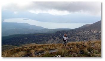 We were soon beneath the clouds and could see Lake Rotoaira off in the distance.
As we descended we passed by some hot springs on private land. In the cool air the springs put out lots of steam and vapours.
About half way down we passed the Ketetahi Hut which offered a final rest break and views of the way ahead. Descending further, and below the elevation of the start of the hike, the terrain changed quite dramatically. 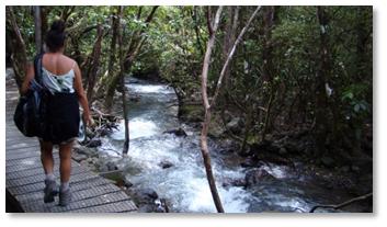 Having been in nothing taller than brush all day we were now walking through forests and at times walking by running streams and over bridges. Once we left the streams the air warmed up and before long we were at the rally point to wait for our pickup. Ben had made it down first along way ahead of Helen and I.
Around 3pm our bus arrived and we were whisked back to Whakapapa. Along the way we could see the peaks we had climbed but one would have no idea, from the vantage of the road, of the incredible plateaus and views we seen while crossing the passage. Back at the kitchen we quaffed well earned beers. We learned from a poster in the kitchen that a lot of the Mordor scenes from Lord of the Rings were filmed in the park. At times we had felt as though we were hiking through the plains of Mordor and Helen felt at one point as if she was ready to have Sam carry her up the last slope.
With all the pictures to filter through and much to write I passed on writing the blog yesterday evening leaving that until this morning. We were all fast asleep before dark. Today we’ve decided to do not much and rest our limbs. We’ll spend some time figuring out our next stop before driving off tomorrow.
When I get a chance I’ll start uploading all the pictures of this trip. Look at them in full screen mode if you can and you may get a sense of the fantastic hike we’ve had. If you don’t see the collage at the end come back as we’ve still more pictures to upload.
